| Ecosystem |
Okavango |
| Type |
River (basin) |
| Salinity |
freshwater |
| Other Names |
Okovanggo, Kubango, Cubango (Ref. 6318) |
| Location |
|
Mainly situated in Angola, Namibia and Botswana, southern Africa |
12° S 22° S - 15° E 26° E |
|
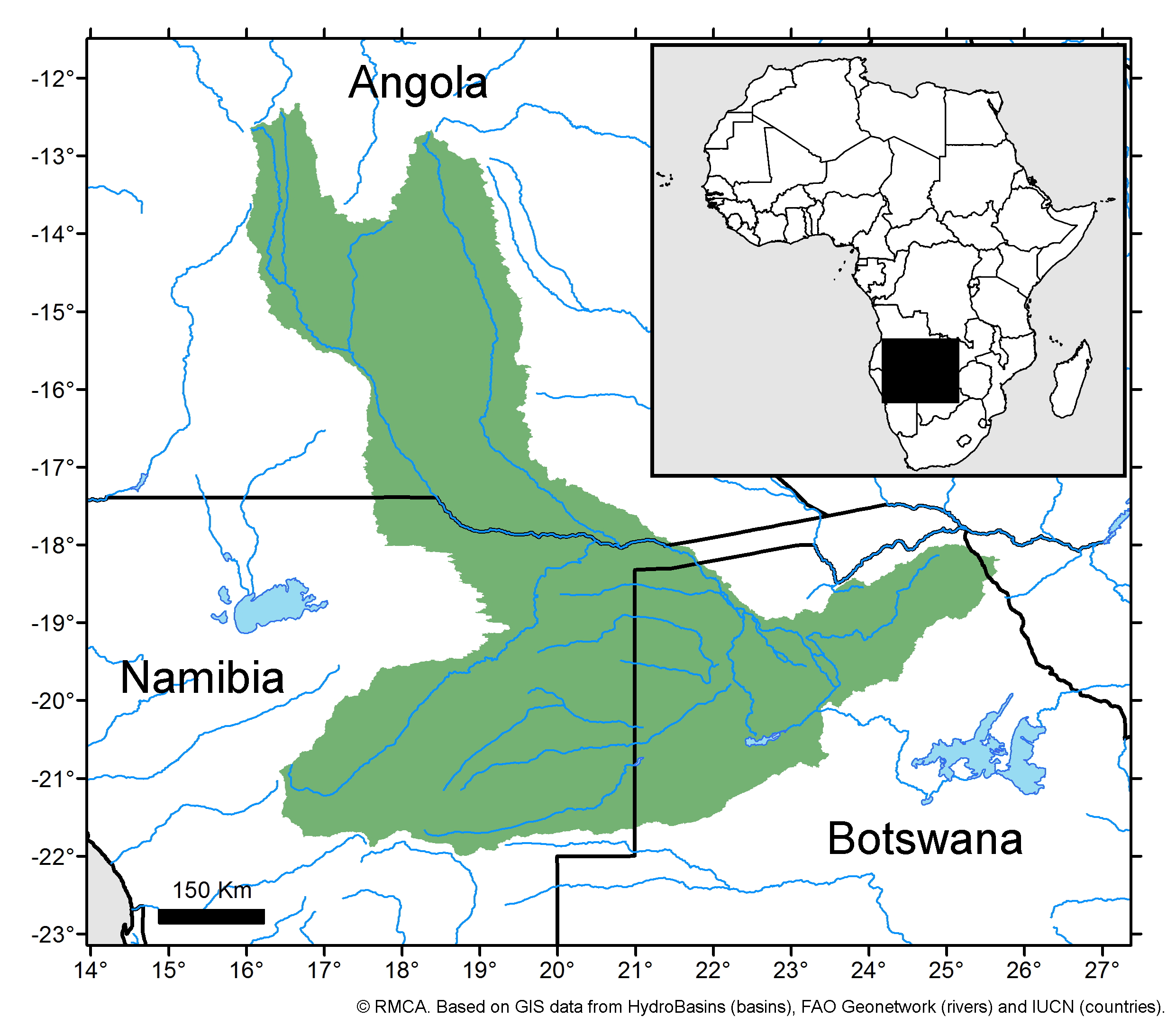
| Location Map |
E_CODE 69_mod.jpg |
| Size Ref |
|
River Length |
1800 km |
Area |
|
Drainage Area |
785000 |
|
| Depth |
|
Average Depth |
|
Max Depth |
|
Ref |
|
|
| Temperature |
|
| Description |
Rises from watersheds shared with the west-flowing Angolan Rivers Cuanza and Cunene(Ref. 6316). Forms a section of Angola and South-West Africa boundary, crosses Caprivi Strip and empties into Okavango Basin (Ref. 6318). Joins the Makgadikgadi Salt Pans near Maun. Includes: Cuito, Cuchi, Okavango Swamps, Lake Ngami, Thamalakane |
| Comments on faunal list |
|
| URL 1 |
|
| URL 2 |
|
| Ecosystem Checklist Link |
|
| Total |
|
Species |
Families |
Species |
Families |
Reference |
|
133 |
17 |
79 |
21 |
30553 |
|